


pollinating every plant on earth with satellites
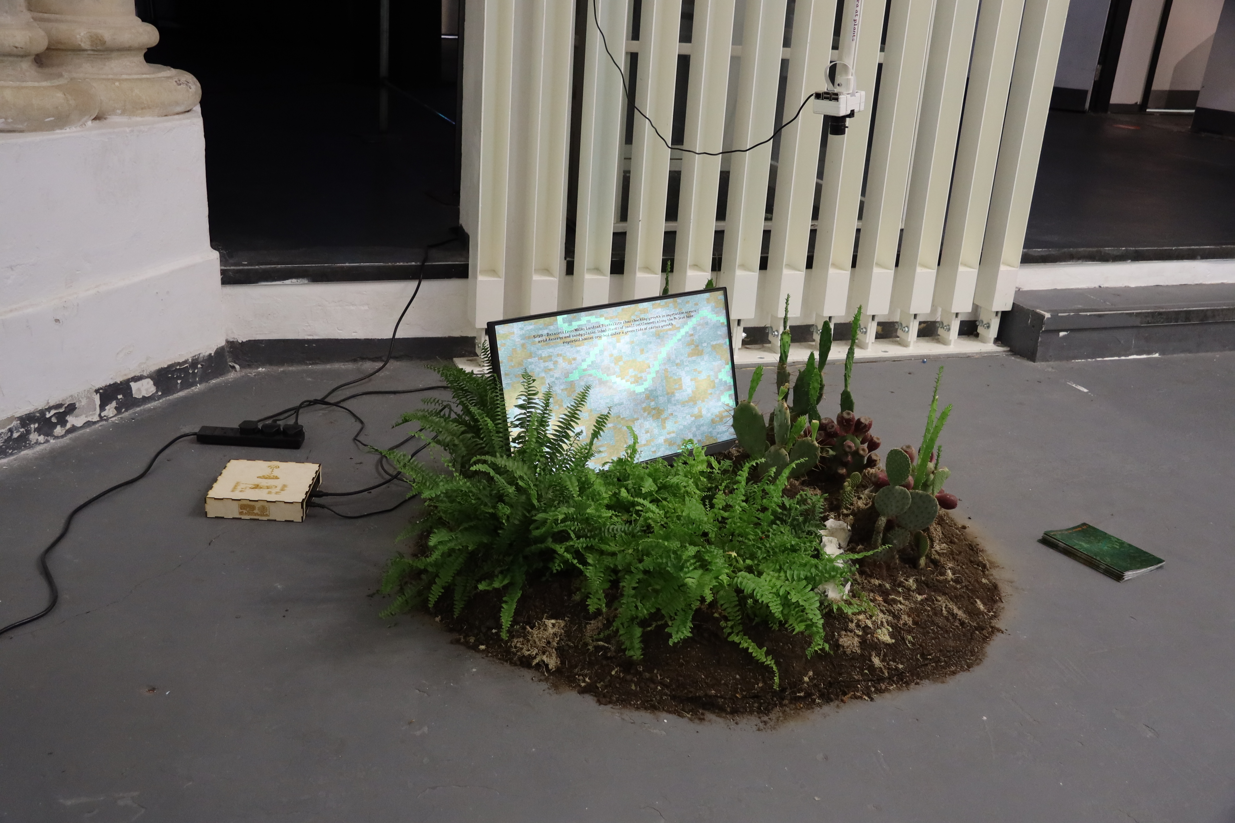
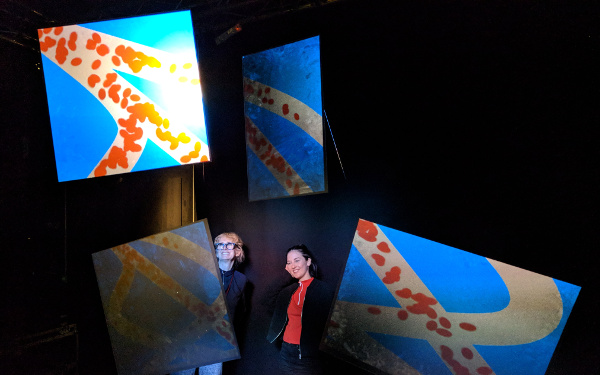
An interactive installation, where users generate maps from satellite images of ferns and cacti by aiming a camera at the corresponding plant. The work is a microcosm of symbiotic evolution, a terraforming process is guided by the creative linkage of organisms, machine and environment.
produced by: George Kuhn
Conceptual Framework and Background Research
The project builds on a model of the evolution of technology I proposed in previous work. Existing philosophies of technical evolution, specifically those outlined by Leroi-Gourhan, Simondon and Stiegler emphasise the reciprocal causation and influence of technology, humans and their environment on each other. However, these theorists differentiate technology from nature on the basis of technology's transmittable nature, its historically saltatory evolution, and its minimum unit of evolution being the society rather than the individual. None of these features were reconcilable with Neo-Darwinism, which predicts gradual changes, changes hard-coded into DNA and individuals as the minimum units of evolution. These are exactly the lines along which Lynn Margulis attacked Neo-Darwinism, showing that a symbiotic logic of evolution, where communities evolve in leaps through the formation of creative linkages between members of the holobiont. This logic produces exactly the behaviour described by technical philosophy.
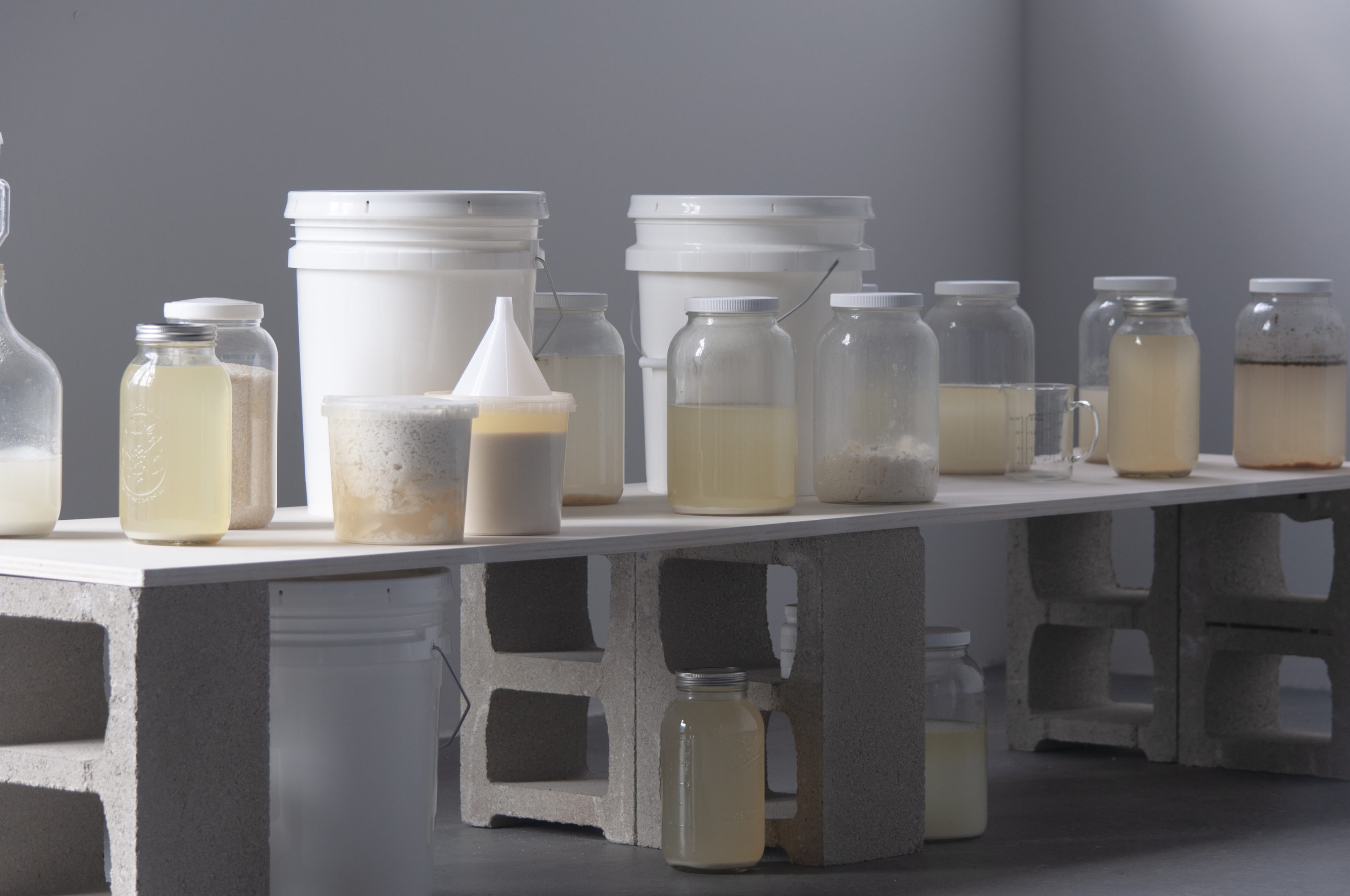
I wanted to create a work that explored the mesmeric feeling brought on by seeing the world around me as carried forward on this symbiotic flow, data through systems that merge together and parasite each other. I chose satellite photography as a vehicle to explore this phenomenon, as it is produced by linking technology and organisms and is intuitively understandable to humans. I pictured how this symbiotic linkage would feel, to a population of plants, like changes in the pattern of planting, deforestation and soil composition, a change in the mapping of the environment. I designed a system that produced new maps through a process that mimics both satellite photography and symbiotic evolution. I took inspiration from other multi-species computational arts projects, which emphasised bringing the collaborating species into the space, for example Tiffany Jaeyeon Shin's M is for Membrane and Rachel Pimm's The Work of Cash Crops. The anarchic and speculative approach to theory is inspired by Ian Cheng's Emisaries Guide to Worlding.
Technical
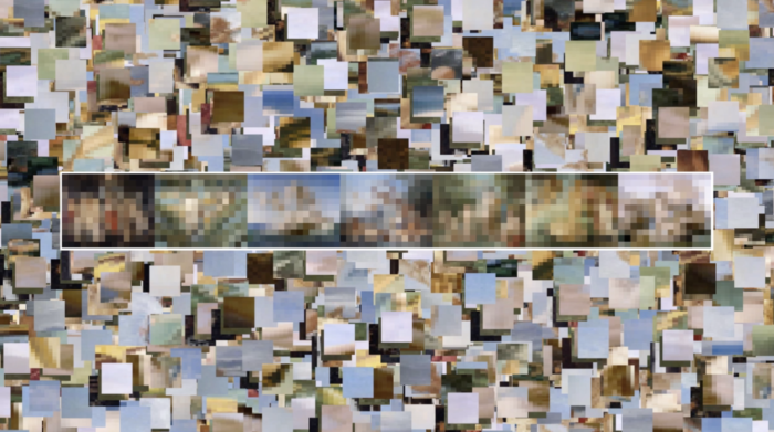
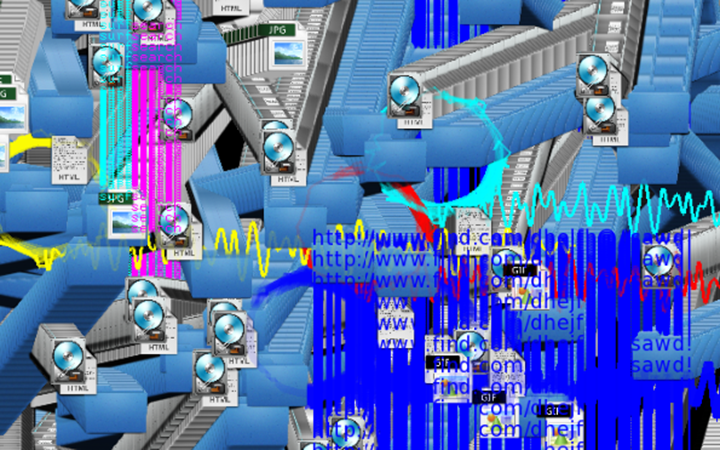
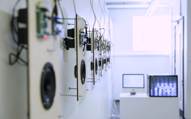
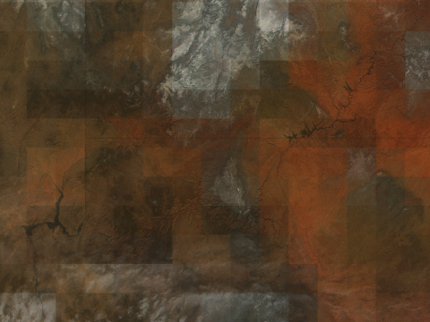
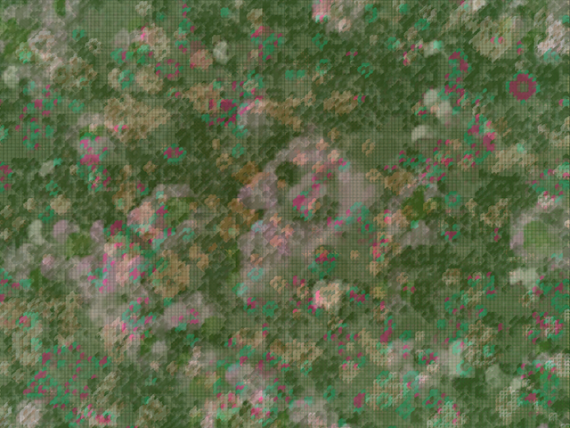
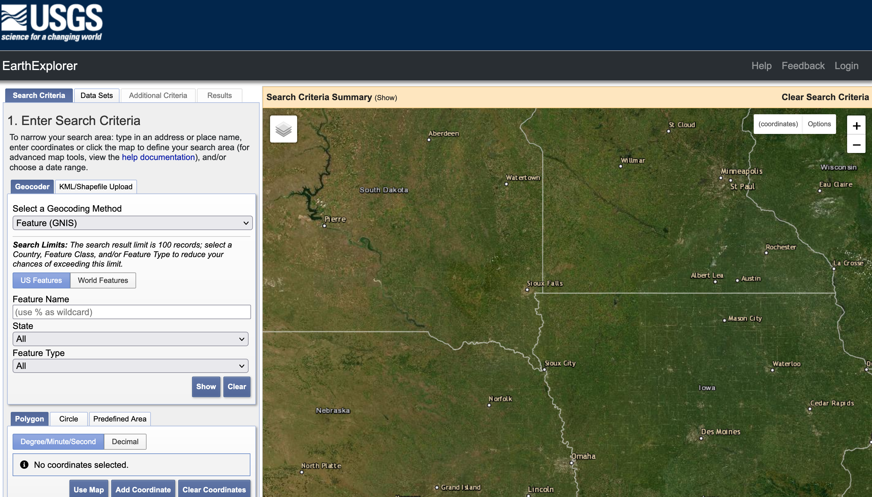
I chose images from NASA's Landsat 8 satellite to make maps from. The satellite is ecologically focussed and images of the entire world can be accessed through earth explorer.
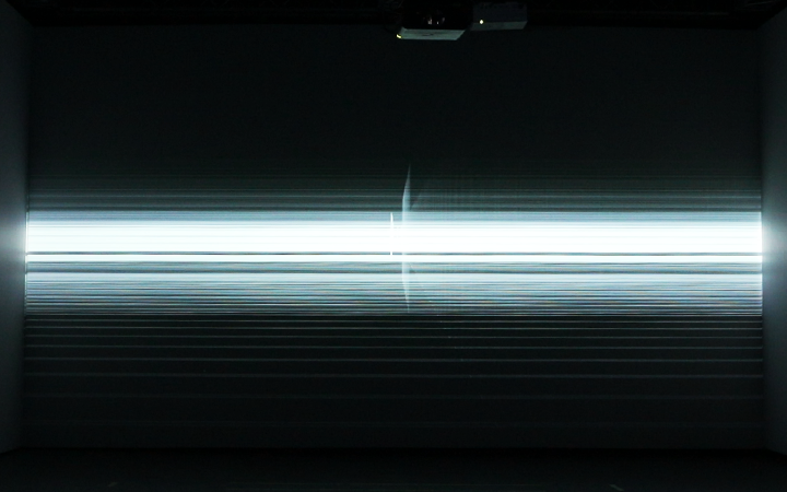
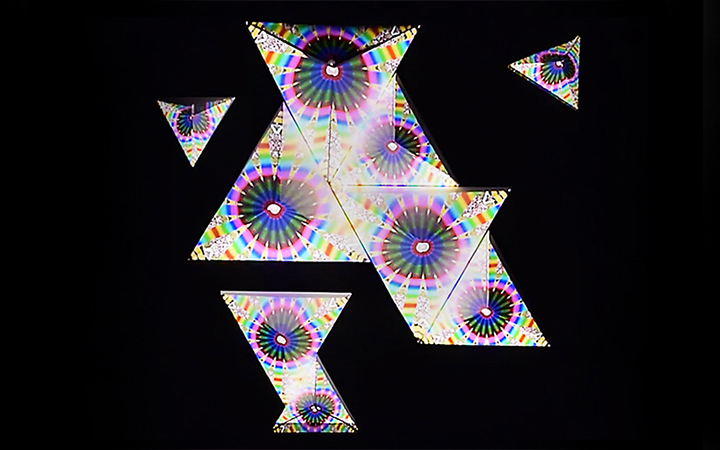
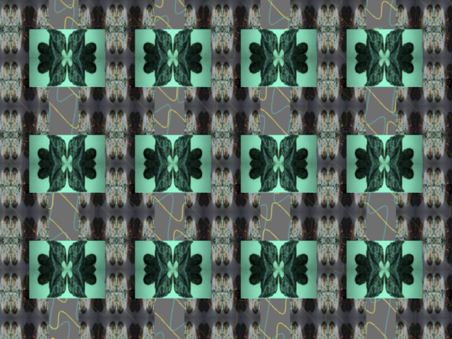
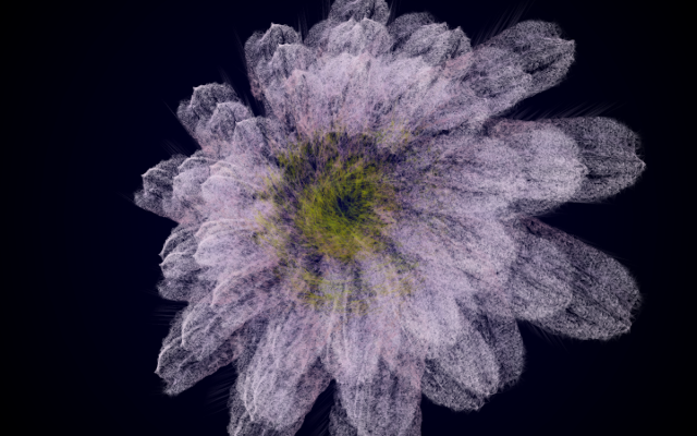
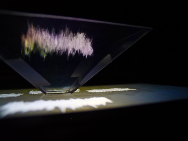
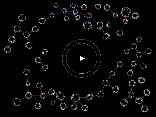
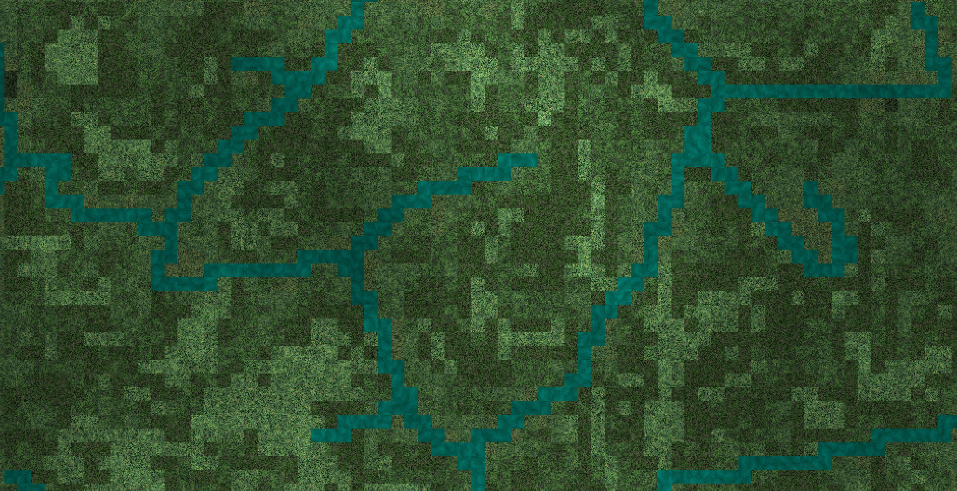
I explored two options for map-making. The first was a wave function collapse system, where I'd be able to feed in 'sample maps' of tile systems, and the program would learn rules about which tiles could be neighbours from the samples, then apply these rules when generating new maps. However the approach was over-complicating the problem, especially considering I didn't want to edit the images too much, so making them fit together neatly would be impossible. This approach was also much slower when generating large maps, so would make the interaction feel less responsive. Instead I looked at combining algorithms inspired by 'nature'. I generated initial maps by using a noise function to decide where to place tiles, and darkening or lightening tiles to produce the correct gradients. Over the top of these maps I used two space colonisation algorithms (meander and branching) combined with a 2-D ray tracing algorithm to create rivers. I then modulated tiles by distance from rivers, embedding the rivers into their environment. Loading and drawing so many high resolution images was slow, so I opted to use shaders to do this instead. I used a second order fbm to create the impression of clouds overhead, and then rhythmically moved the images, echoing the circular movement of the satellite and chasing the mesmeric feeling.
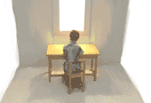
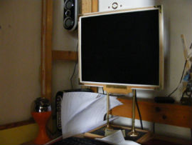
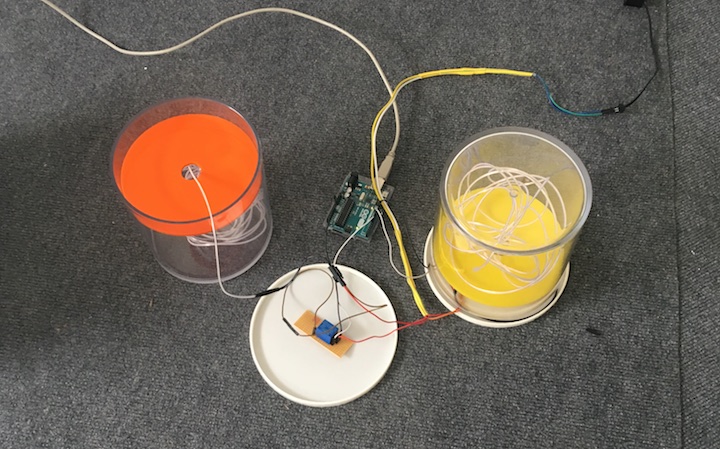
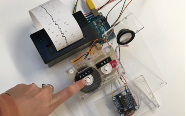
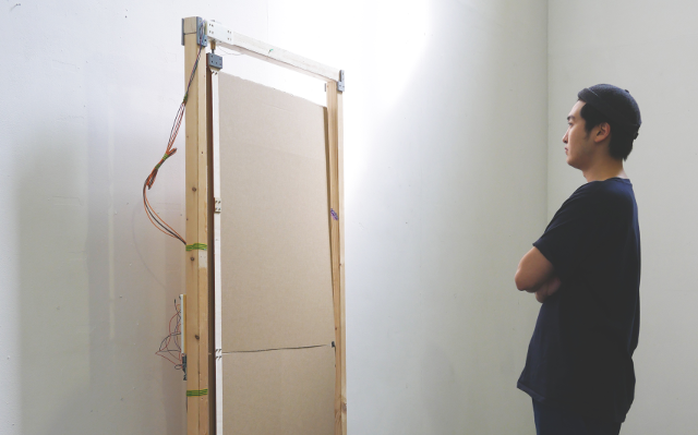
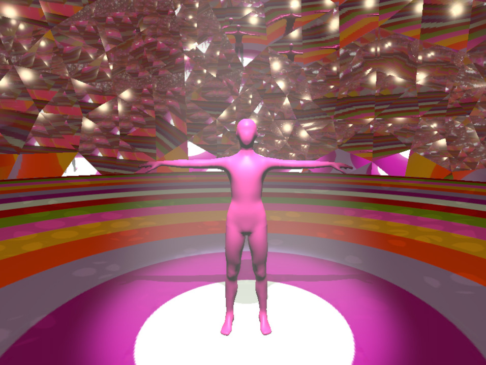
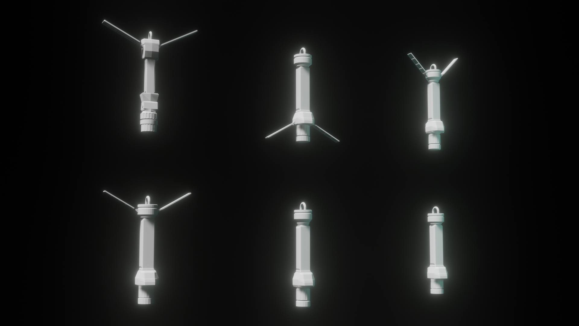
I explored two options for the core interaction, working through both with my crit group to strike the balance between most intuitive and thematically consistent method. The user needed a method to choose plants from within the exhibition space to generate maps from. The selection process should echo the act of satellite photography, I preferred the idea of using a camera for the interaction. I then needed to design an interaction that felt intuitive. I didn't want to have to explain how to use a camera to users, so instead settled on a pendulum-like design with a camera affixed to the base. The circular swing of the pendulum mirrored the orbital motion of a satellite, which felt thematically consistent. By moving the pendulum-camera over a plant, the user generates a map using satellite images of that plant's habitats. I went through several possible designs, but chose to keep it as simple and tool-like as possible to encourage interactivity.
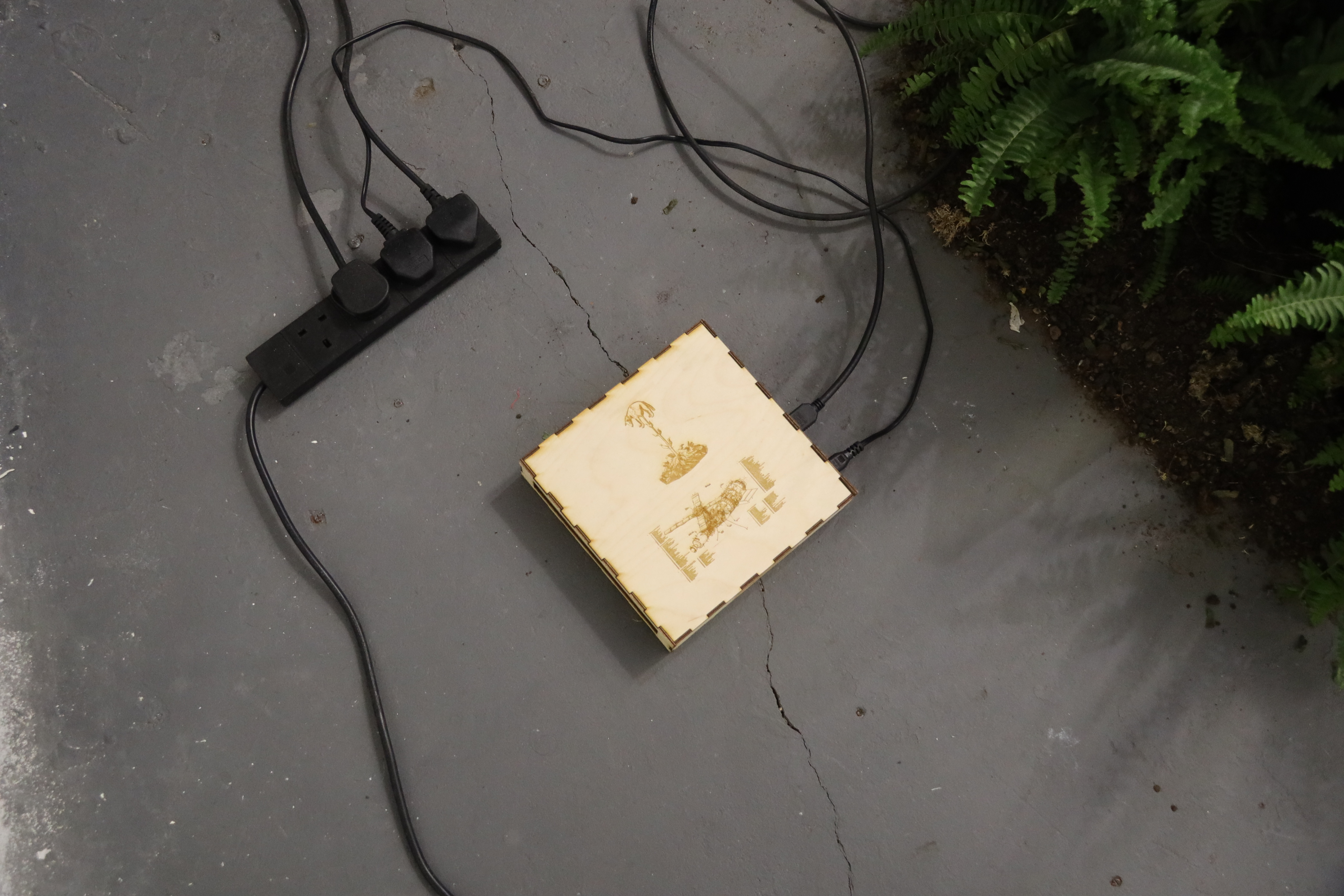
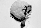
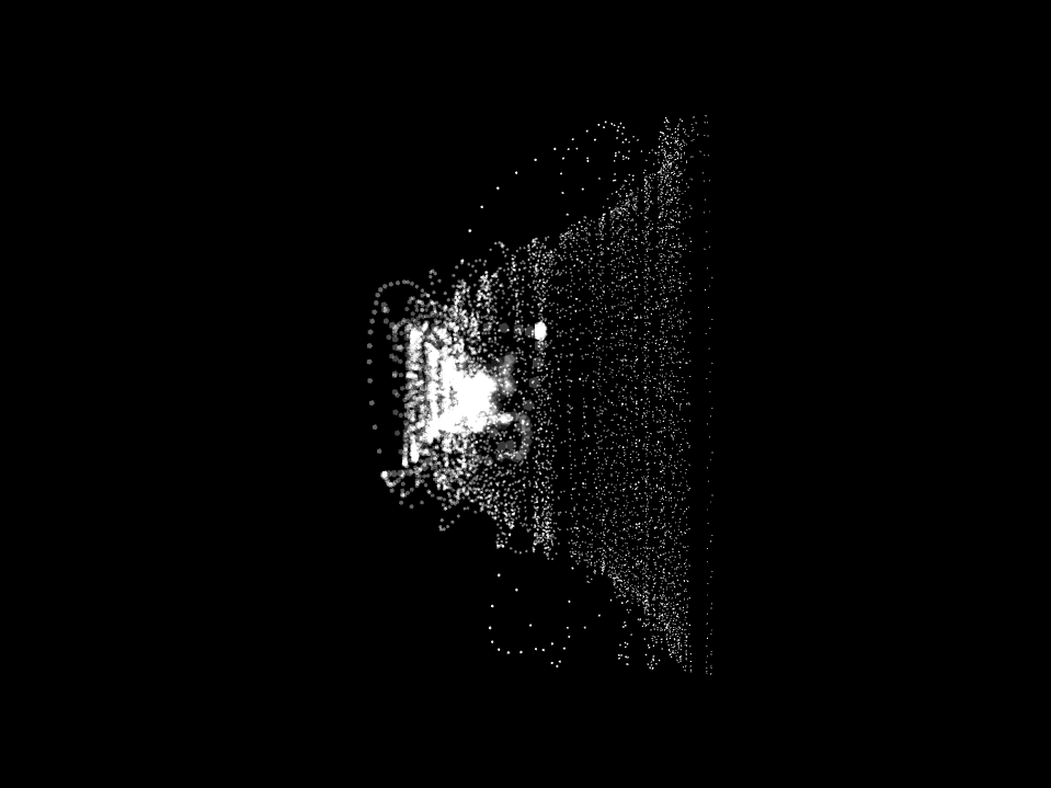
To identify the plants I experimented with machine learning approaches, scraping the web for images of cacti and ferns to train a google teachable machine model, then exporting to tensorflow so it could be integrated into an apop that would run on raspberry pi. However with many plants in close proximity I found the identification to be unreliable, and instead chose to track a colored token in the centre of the plants. The position of the colored token on screen space could be used to work out which plant the camera was aimed at and each fragment of the story I wrote is assigned to a specific direction.
Self Evaluation
I think that the project succeeded in capturing the mesmeric effect that it set out to. I like the slow circling of the image, the way the photos drift together, creating a landscape that breathes but with a machinic rhythm. I think the zine I made worked well, combining hyper-technological with biological imagery, rendering difficult theory comprehensible through narrative framing and a frantic writing style.
I think the major area for improvement was user interaction. Small differences, like fades instead of sudden jumps between text and landscapes would improve the responsiveness and feel of using it. As discussed earlier, a more intuitive and inviting interface for users would also encourage audience memebers to participate in the project and hold their attention for longer. Audience members need a better fish-hook into the project, a way of immediately situating themselves without reference to the theory.
Future Development
The project could be developed into a closer analogue for satellite photography by gameifying it further. The project could be shown on two screens. Showing the map on a single screen would improve the immersive psychedelic effect. The second screen would be a minimalistic interface, communicating with users to program movements for the satellite camera, and then unveiling a story in response.
The project could also be taken further by integrating a way to search and make tilesets directly from the earth explorer database, extracting tiles from areas where the plants grow. This would allow for generation of much more varied maps, as well as encourage users to continue interacting with it.