


SITE/SIGHT/CHOICE/CAST: a research journey through space, time and things
produced by: Batool Eldasouky
Through embarking on an investigative artistic research journey, the project presented in this report is an attempt to tell a story that is both intimate and entangled in the midst of larger systems, places, software and policies. However, through anchoring the research in the impersonal realm of digital mapping archives on one end and then extruding it towards that of mysticism on the other, I hope to sidestep the somewhat exhausted romanticism that often houses the discursive spaces similar to what this research engages in.
My research focuses on notions of distance as the product of transience and displacement created by the policies of Gulf countries, by observing and exploring places through the interface of Google Earth, and coupling that with notions of memory, paralleling the digital storage of the Google Earth archive with the notion of a collective memory, asking what kinds of relations the two facilitate with places at a distance (Awan 2016).
To do so, I try to look away from the central object of offense (policies of Gulf countries) and around towards what surrounds it (Harney and Moten 19). Looking for what can be made of other products and platforms that can be utilised as tools that might not have been intended for us to use in ways beyond consumption, but which nonetheless are available to anyone with a functioning computer and internet connection. Part of my methodology is informed the necessity of taking a DIY approach that subverts omnipresent structures and uses products that have been made by a system do produce work that is critical of its own means.
I used the online archive of Google Earth as it is an accessible and free platform even though it comes at the expense of a “richer” image (Steyerl 2009), taking the digital memory it stores as an archival body (Bruno) and treating the platform as an automated archiving practice that through the god-like gaze of GIS mapping and imaging has also become a phenomenological presence of background relations with the places it represents (Rosenberger & Verbeek 2015).
This research also proposes (for the purposes of this project) to take this digital archive/storage as an alternative to, or a placeholder for, the currently missing – or perhaps only scattered – collective memory, which I speculate is due to the absence (or perhaps the scattering) of a defined collective (García-Gavilanes, Ruth, et al 2017).
I chose to look at the geography of a place as a way for grounding this scattered sense of a collective and to perhaps gain access to some tools to embody this erasure. It was obvious that the transient collective I was searching for had a place in common within the Gulf, and with that in mind I went on to ask if there is something inherent to certain a place that creates forgetfulness, and as a result softly perpetuates transience and displacement (Gross, 2017).
SITE
To access the site in question for this research I had to look through several mediating platforms of varying transparency/Looking through several screens of mediation of varying transparency (Rosenberger & Verbeek 2015).
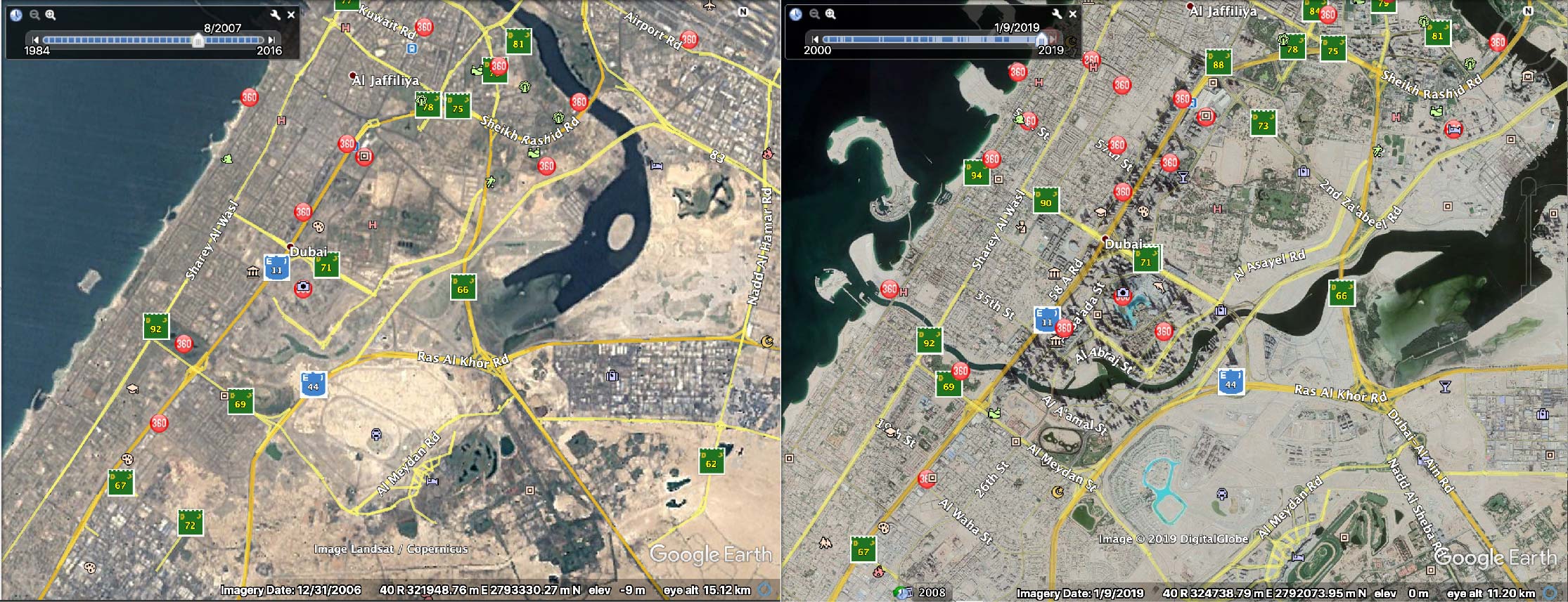
The first layer of mediation, Google Earth images, was to help bridge some of the several lengths of distance between myself and Dubai. Where distance is present in a topological as opposed to a topographic sense — quantitating distance by counting the iterations of barriers rather then measuring the space between two things (Awan 2016).
On the one hand, gaining sight of the city, in a paradoxical manner, added to the distances by confining my access to it to the interpretive tools of the interface of GE (Rosenberger & Verbeek 2015). On the other hand, GE provided access through a dimension that previously only lived in memory, though the Historical Imagery option, granting access to versions of the site over time.
The other layer of mediation was one within the GE platform itself, which is the CRS systems used by GE to create the map images it presents — to figure the earth so to speak, and create a mathematicisation of the globe, which due to the impirical appearance of the imagery and the association with a mathematical process can easily be mistaken for objective representations (Awan, 2017).
However, this was very quickly revealed not to be the case when GE simply asks the user to choose which coordinate system to set in the preferences of the programme, immediately opening up the space to question where the implications of choosing any of the different notation options.
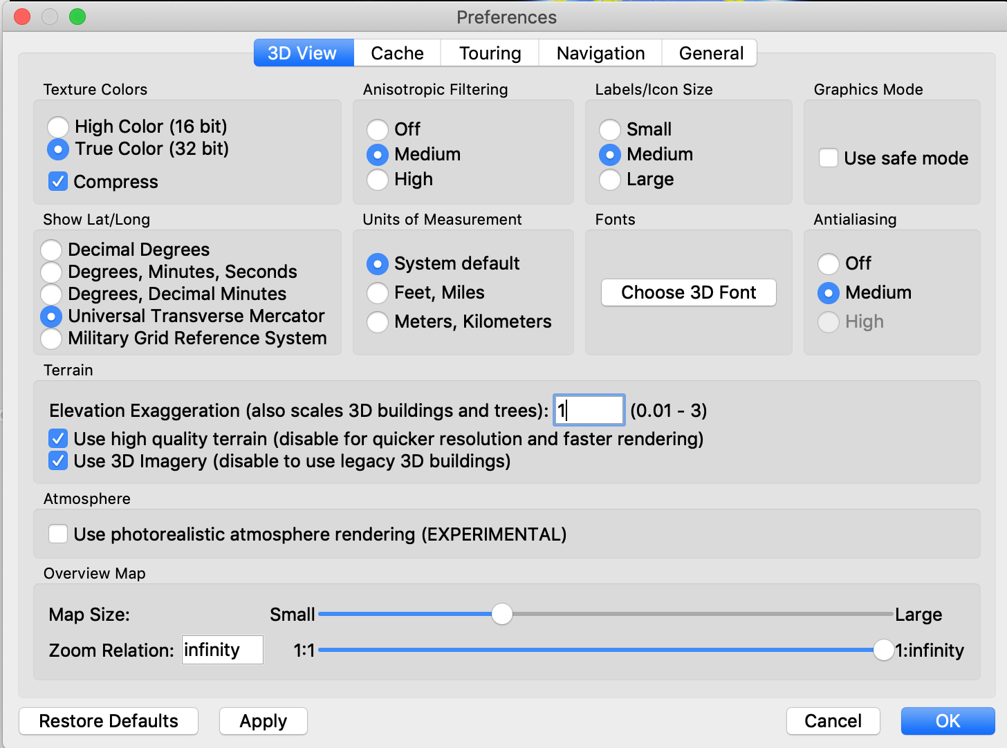
Looking for a an explanation as to why so many different existed to describe what seemed to be an objective/straightforward grid of latitude and longitude proved to be a labyrinth that wound around yet came back to two core concepts. One that sees the Earth as a more or less flat ellipsoidal surface (which was the preferred approach for international coordinate systems like GPS), and one that sees the Earth as a more nuanced ellipsoid of varying elevations on its surface (which is the preferred approach of national systems to draw more accurate maps for their region) (Thomas, 2017).
This discrepancy/ difference was relevant to understanding the origin/and intentions behind the tools we were given with which to figure the Earth, and further research revealed that the datums that almost all CRS systems are based on were either developed by oil companies or a military (Warner 2002). It was important to pause here are note the subversion of mediums and intentions.
The Global Positioning System (GPS) as well as the Military Grid Reference System (MGRS) were created by the US army based on the WGS84 coordinate system which has sometimes been referred to as the EPSG:4326 system (Warner 2002). EPSG stands for European Petroleum Survey group, which In 2005, the was absorbed into The International Association of Oil & Gas Producers (IOGP) (a global forum of petroleum industry companies) and ceased to function as a independent entity. Parallel to these globally used systems, the UAE uses the Nahrwan 1967.
This project treats CRS as the technical counterpart to theories of spacial perception and a level of hermunietic relations with between, in this case, my eyes and the “world” (Rosenberger & Verbeek 2015).
So, when we use Google Earth, the question of who is mediating our perception of a place reaches far beyond Google or its own motivations as a company and transforms into an almost existential questioning of who says what is where.
SIGHT
Coming in and out of view through this exercise was the opacity and blind spots of the interface of GE on a functional level.
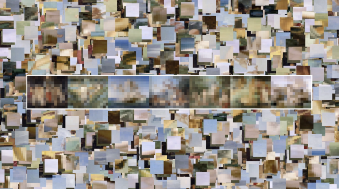
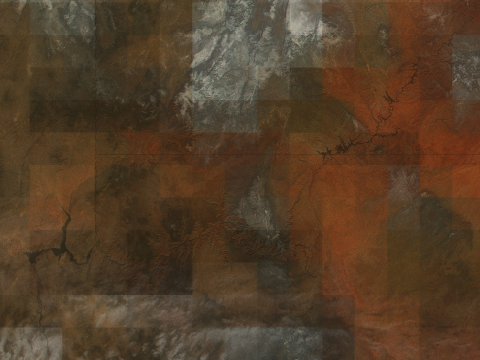
In some places and times (also the times of recorded in the Historical Imagery slider) the images are crisp, clear and of a good resolution to allow for zooming into at times pixelated, and in other places and times (usually in older images) pixelated, and yet on other years available, being substituted instead with great expanses of blurs that look like fogged glass.
Firstly, I found myself looking down at the earth but also straight ahead at the screen. This multiplicity of perspectives created a duplicity/duality in the spaces my body was occupying and made apparent the levels of abstraction that my eyes have to decipher to read the map.
Eventually, the images of the city revealed parts of the city that look abstract, flattened and in need to decoding and other parts of the city that look like they were almost made to viewed from here (Strick 2019). However, there are parts of the city that almost revealed themselves or took their true form when viewed from the map. I realised that much (of the newer parts) of the city where designed to be viewed from the sky.
Even though many cities are remarkable to see for above, but this city in particular built itself with an awareness of an elevated gaze. The gaze of a Helicopter tourist, an investor, a resident of the worlds tallest tower, the gaze of a plane, a bird, a satellite, a God.
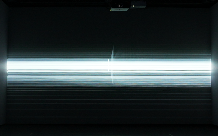
A short text piece in the form of instructions emerged from the experience of looking, which is presented as part of the artefacts alongside this report.
CHOICE
The act of choosing was very visible throughout this research and became apparent at several stages. Choosing to attribute notions of collective memory to the Gulf, meant choosing an affinity and by extension choosing to belong (Awan, 2017). Though contradictory to traditional definitions of belonging, making a choice was in fact empowering for the decision-making process about the sites I took as the objects/subjects for the next part of the research.
I chose the following spots to explore:
1.
‘The canal through the park’ which is an extension of a smaller naturally occurring creek from one side of the city to the other in a meandering U shape leading the creek back out to the sea, effectively engulfing the downtown area of the city into an island.
I chose the canal because it is both an intrusion on and ‘forcing of’ the geography of the land to mould to the vision of the developers and/or the state. In its wake, the canal project cut through half of a public park and a few residential houses that were on its path, making also a good example, being an artificially forged natural element changing an urban landscape.
2.
‘The new old souk’ which is an extension of an old market in the neighbouring city, Sharjah, that was built in the same style of the original market in that area on top the excavated site of itself.
The souk is an example of a contemporary development which attempts to resurrect a version of itself into on claims of historic grounds, erasing in the nostalgic romanticism half of the parking spots on the street and a very valuable U-turn.
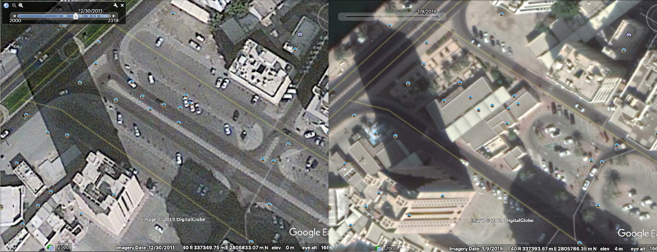
I captured each site over several years at every possible iteration. Due to the gaps in GE’s timeline and the irregularity of the intervals between each image, the captures do not evolve at a regular pace, calling into question the value of a linear timeline altogether and the distortion created as a result of confronting multiple time spaces at once.
MEMORY:
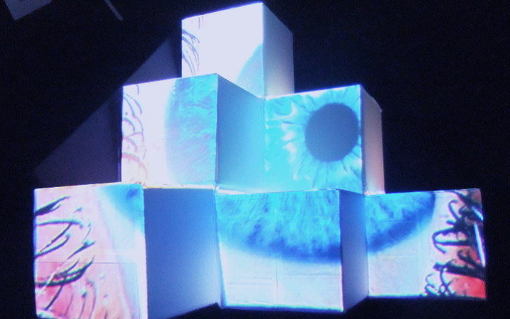
These captures were then used to trace the contours of change within each site from one frame to the next, with the intention of creating an object/thing that can simultaneously carry the information extracted from the map and transcend beyond the status of an information carrier to become an object that resonates with memory that is larger than the notion of storage (Bruno; Bennett 2009).
I speculated on the possibility of collapsing the linear record of time into one object that compiles all the different contours of the topography of a site and hence records accumulations of change as opposed to accumulation of time.
In many ways, this would mirror the temporal realms of both the Internet (as space of infinite presents and all of history at once), Google (with its incessant archiving machine) and the developing forward churning city (a place of futuristic utopia with nostalgia as history. Both modes fuelled by the strive towards the infinite and immortal (Lagerkvist 2014).
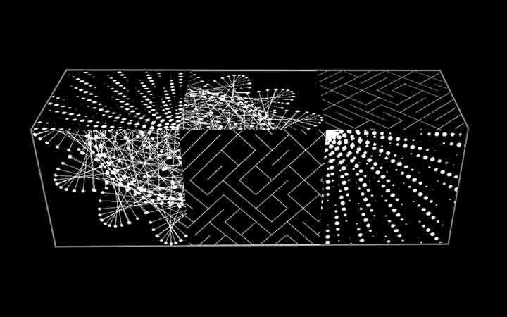
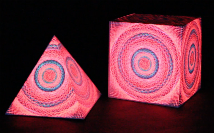
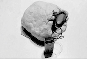
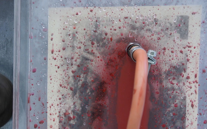
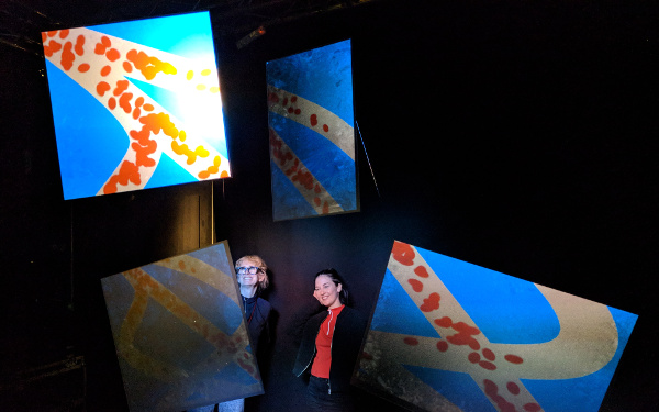
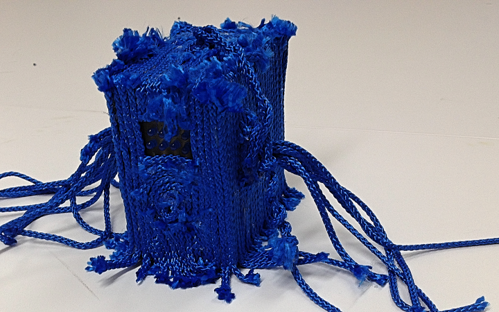
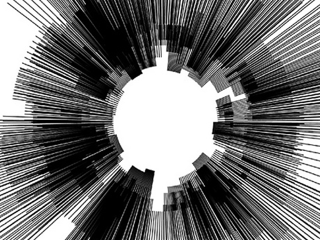
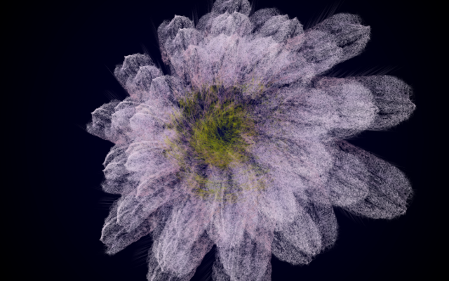
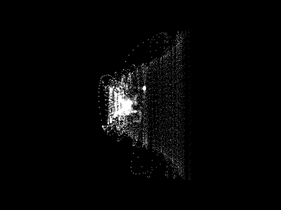
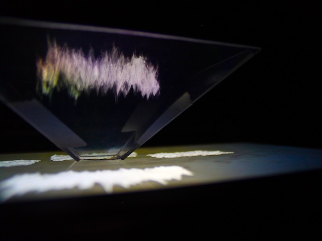
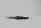
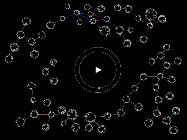
Below are images of the 3D models that were the product of the two sites discussed in the previous section:
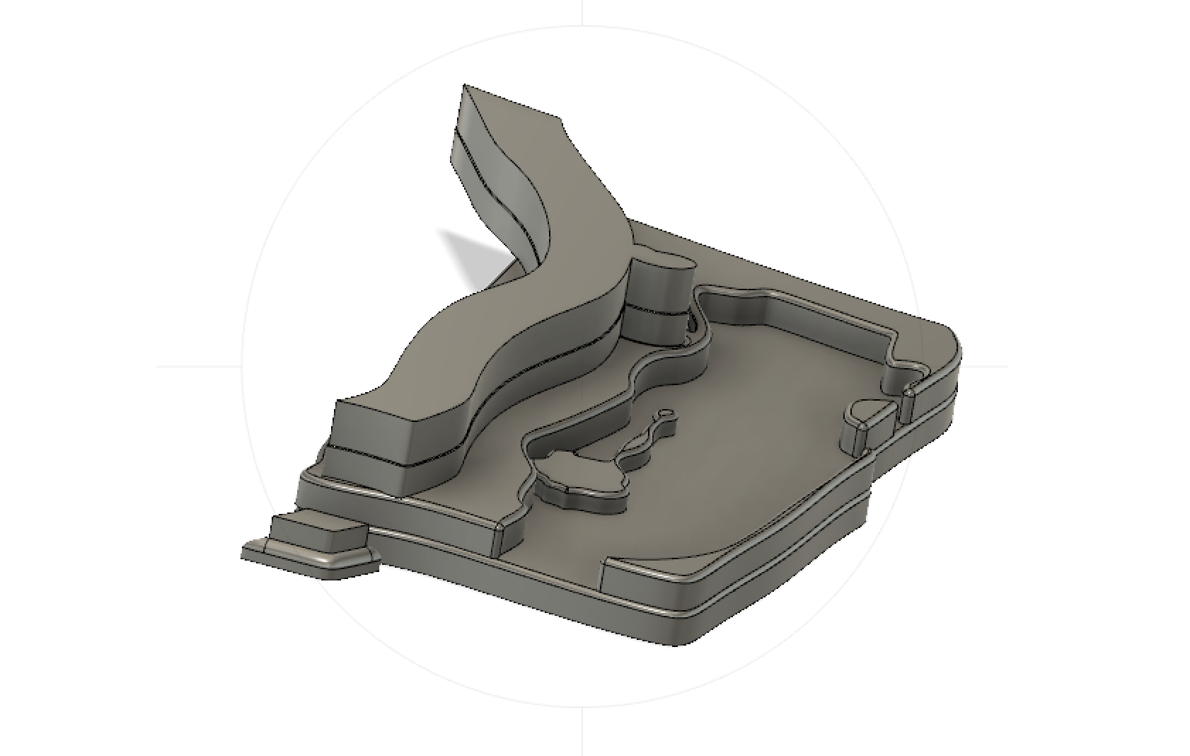
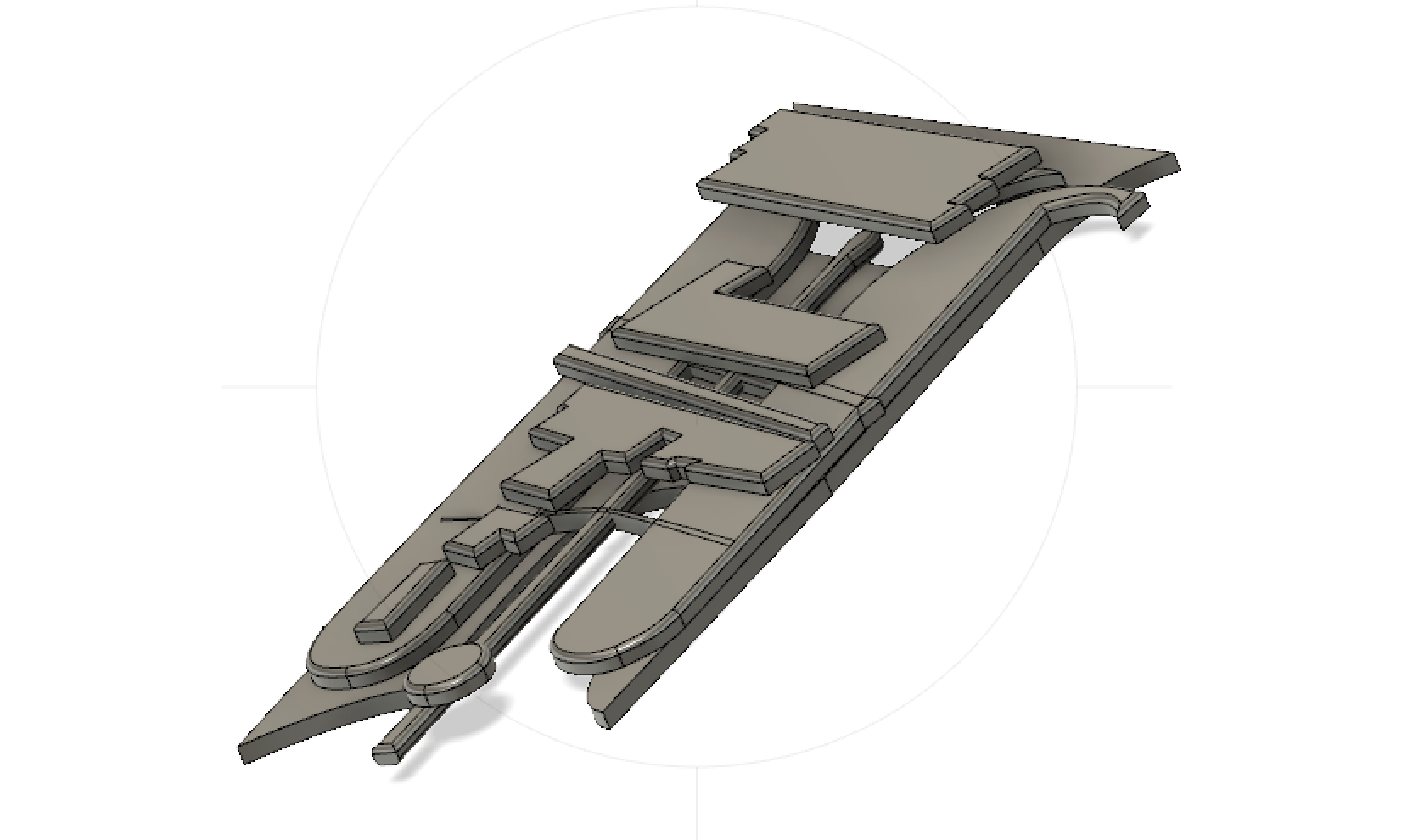
On one object, the contours resemble buildings, roads and harsh edges, while on the other they take the form of meandering blobs and streams and rounded corners — but in both cases these are outlines are the result of tracing demarcations of change, as oppose to outlines of identifiable forms.
From here on, the traditional subject/object dichotomy begins to blur and become interchangeable, as the models take form as things that emanate an energy beyond the technical work from which they were assembled (Bennett).
I also want to propose these objects as data carriers. Even though the shapes that they hold were not empirically extracted, nor were they extracted from an objective representation of the sites they represent, they still carry memory and data and in that sense can be seen to function in a similar manner as other data carriers like USB sticks. with the difference in the kind of memory that they encapsulate giving them a more intangible property/more intangible kind of memory. Each shape is actually the outline of a difference in the landscape.
CAST
Finally, and to draw a circle back to forgetfulness and the search for a collective, I want to now round up this journey and cast its narrative into a condensed string:
The search for a memory revealed the need to search for a collective to carry it. In the absence of a collective I looked instead to a place. How do we look at a place through time, space and tools that come laden with histories and intentions? What does it mean to remember a place through the memory of software that creates an aggregate of storage facilitated by a commercial, corporate body, which in turn is facilitated by the existence of even older corporate and military bodies.
If by this point this memory is ours at all, who's story does it tell and how can we then situate our relatively small traces within this web of histories and relations? Even though we have chosen, searched, looked, subverted and extracted, how can we take agency over the “energy” of these places/sites compiled into these objects. What other tools have we available. What level of mystical DIY can one employ and how can notions of magic and mysticism aid this purpose and serve as a form of resistance.
A second short text piece in the form of instructions emerged from the experience of casting, which is also presented as part of the artefacts alongside this report.
Annotated Bibliography:
Awan, Nishat. “Digital Narratives and Witnessing: The Ethics of Engaging with Places at a Distance.” GeoHumanities, vol. 2, no. 2, 2016, pp. 311–330., doi:10.1080/2373566x.2016.1234940.
Awan, Nishat. Diasporic Agencies: Mapping the City Otherwise. Routledge, 2017.
Both of Awan’s texts informed my engagement with elements of space and time, the first providing valuable direction to engage with distance and places, and the second for understanding value added to objects like maps and memories.
Bennett, Jane. Vibrant Matter: A Political Ecology of Things. Duke University Press, 2009, https://www.dawsonera.com:443/abstract/9780822391623.
Bennett’s theory of thing power heavily informed my interaction with the several things that I came upon throughout this research. From the layers that mediated my search, to the city I was observing through those layers, to the objects that emerged from them and how to be able to converse with all those nodes.
Harney, Stefano, and Fred Moten. The Undercommons: Fugitive Planning & Black Study. Minor Compositions, 2013.
Moten and Stefano’s text provided a general foundation for understanding alternative methods of critique and resistance.
References:
Awan, Nishat. “Digital Narratives and Witnessing: The Ethics of Engaging with Places at a Distance.” GeoHumanities, vol. 2, no. 2, 2016, pp. 311–330., doi:10.1080/2373566x.2016.1234940.
Awan, Nishat. Diasporic Agencies: Mapping the City Otherwise. Routledge, 2017.
Bennett, Jane. Vibrant Matter: A Political Ecology of Things. Duke University Press, 2009, https://www.dawsonera.com:443/abstract/9780822391623.
García-Gavilanes, Ruth, et al. “The Memory Remains: Understanding Collective Memory in the Digital Age.” Science Advances, vol. 3, no. 4, 2017, doi:10.1126/sciadv.1602368.
Gross, Jack. “Soft Borders.” The New Inquiry, The New Inquiry, 15 Sept. 2017, thenewinquiry.com/soft-borders/.
Harney, Stefano, and Fred Moten. The Undercommons: Fugitive Planning & Black Study. Minor Compositions, 2013.
Lagerkvist, Amanda. “The Netlore of the Infinite: Death (and beyond) in the Digital Memory Ecology.” New Review of Hypermedia and Multimedia, vol. 21, no. 1-2, 2014, pp. 185–195., doi:10.1080/13614568.2014.983563.
Rosenberger, Robert, and Peter-Paul Verbeek. “A Field Guide to Postphenomenology.” Postphenomenological Investigations: Essays on Human-Technology Relations. Lexington Books, 2015, pp. 9-39
Roth, Tom. “EPSG Codes Explained.” Puzzlr, 30 May 2017, www.puzzlr.org/epsg-codes-explained/.
Steyerl, Hito. “In Defense of the Poor Image.” e-Flux Journal , no. 10, Nov. 2011, www.e-flux.com/journal/10/61362/in-defense-of-the-poor-image/.
“Storage Space.” e-Flux, www.e-flux.com/architecture/superhumanity/68650/storage-space/.
Strick, Benjamin. “How To Use Google Earth's Three Dimensional View: Feat. Syria, Yemen, Sudan.” Bellingcat, 5 Mar. 2019, www.bellingcat.com/resources/how-tos/2019/03/05/how-to-use-google-earths-three-dimensional-view-feat-syria-yemen-sudan/.
Thomas, Adam. “Datums, Projections and Coordinate Systems.” RECORDER, vol. 42, Mar. 2017, csegrecorder.com/articles/view/datums-projections-and-coordinate-systems.
More Details about the UTM Coordinate System, www.maptools.com/tutorials/utm/details.
Warner, Deborah Jean. “Political Geodesy: The Army, the Air Force, and the World Geodetic System of 1960.” Annals of Science, vol. 59, no. 4, 2002, pp. 363–389., doi:10.1080/0003790110044756.